Up the Ancient Silk Route
10 min read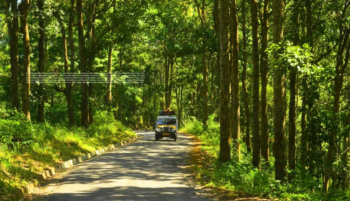
As part of the ancient network of trade routes that connected India to China the silk route through Sikkim was the most important one. The ancient trade route known as the silk road crossed the national border at the high altitude Jelepla Pass and connected mainland China to India. It’s considered as the first information super highway in the world which was the main route for trade of gold, copper, cotton, sugar, tea, horses, spices and silk.

I met Nima Pradhan for the first time on a misty Sunday morning when he came to pick me up from my hotel in Kalimpong along with Gopal. We were to travel the length of the silk route together in the same car with Nima as the guide and Gopal the driver for the journey. Kalimpong a small bustling town nestled in the Himalayan foothills is an important trading hub dotted with shops selling various things starting from warm clothing to spices, from construction material and sanitary ware to fancy electronic gadgets. A large portion of the wholesale and retail trade of the region takes place here with it’s reach stretched out to hundreds of kilometers into the countless number of remote hamlets and villages of the hilly region. Though the source of the supply chain today are the large cities in the plains of India and the Kalimpong town serves as a routing point of distribution in the mountains, for hundreds of years this same bustling little town served for the same cause but on a different route. A much longer and wider trade route from the capital of Tibet through the high altitude passes going right through Kalimpong into the plains of India to the port town of Tamluk in Bengal, through which the maritime trade route continued to the markets of south east asia.
Today the portion of the silk route within India which is several hundred kilometers takes about 5 days to complete passes through a handful of important villages all reminiscence of the rich trading past giving the traveler a slice of time intact as it was centuries back. It is the region’s most interesting tourism experience about a journey that takes one through the exotic landscape, culture and people of the place, most of whose forefathers were associated with the silk road trading.
The Route
As we travelled from Kalimong on the thick hilly forested road and headed towards Aritar. I came to know 37 year old Nima’s my guide’s father was one of the couriers of the Ancient Silk route from Kalimpong to Lhasa through the Jelep-la Pass. When I asked which road road they took, Nima smiled and told me ‘ this very road we are driving on now’ He narrated ‘ In those days it took more than a week to walk up to Jelepla which was the Indo-Tibetan border at over 15,000 ft, from Kalimpong. The trade convoys consisted of horse and mule pulled carts with couriers walking beside them’. He stated it was a mountainous path rocky, undulating through forests and river beds. The traders and couriers had to cross a number of rivers and streams with Teesta and Rangit being the largest ones and camp the nights near small hamlets on the way.
As we stopped for some steaming tea served in a paper cup at a roadside shop Nima pointed at the valley beside it and showed me the small hamlet towards the middle of it called Pedong. The ancient trade convoys camped near these hamlets and small villages on the route as they slowly ascended towards Rhenok. Thinking of spending several nights on this meandering road (even though it was a proper tar made one now) was quite uncomfortable given the harsh cold climate throughout the year and ofcourse not ruling out the freely roaming brown bears and leopards in the adjoining forests. In those days it was surely much more challenging.

The other interesting aspect in those days was that this route was at the forefront of the great game in Central Asia involving the British, Russians, Tibetans and the Chinese. The Silk Road or the silk routes were an extensive network of trade routes interconnected with each other connecting the Asian continent with the Europe and Africa. Extending over 4,000 miles, the routes enabled people to transport trade goods while simultaneously serving as a conduit for the spread of knowledge, ideas and cultures between different parts of the world. Trade on the silk route was a significant factor in development and in several respects helped lay the foundations for modern world. Each one of these little villages that we crossed Reshi, Kolakham, Algarah, Rhenok spoke a separate story of that era.

Local Flavour
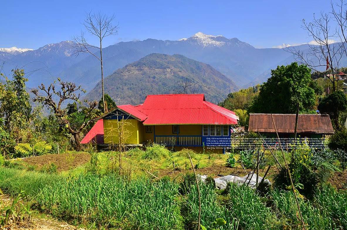
After crossing Aritar, which is full of not very old constructions labeled as budget lodges and hotels, we stopped just before Dalapchand to meet up Jungney a young Tibetan monk who has initiated building the local monastery perched on a plateau. Originally traders from Lhasa his ancestors had settled in the area many decades before His Holiness the Dalai Lama shifted to India. The third generation Tibetan of the place owns quite a large amount of land right beside the route and his family today is one of the biggest black cardamom producers of the region. Every mountain slope visible from his modest house beside the small monastery is full of cardamom plants and they are all cultivated organically. A large portion of the production is exported through this route today, to middle eastern countries and Jungney and his extended family are happy to be instrumental in the process. Over lunch Jungney told us that towards the middle of the last century it was mostly food grains and sugar traded for salt / potatoes and sometimes smuggled gold. Raw silk was also part of the barter trade but less. Many of the town markets along the way still have many of the original shops which traded in the ancient times. The shop owners and their families may have shifted to other modes of business like him but they are still there.
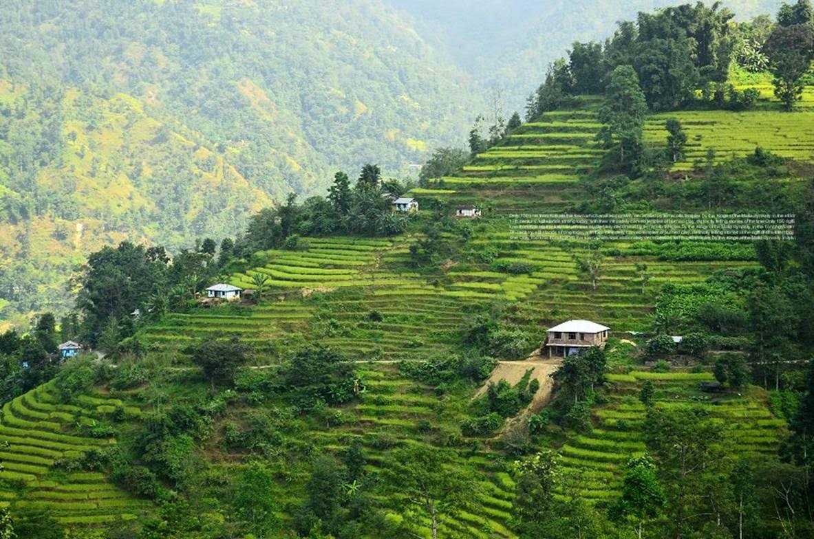
A confident and steady driver Gopal I came to know from Nima was a local of Zuluk and we were to spend the next night at his place. Having stayed in the region since birth Gopal the headman of Zuluk vilage is an all rounder today. A brilliant driver , butler, host and a complete entrepreneur with his amazing world above 10,000 ft. He picks up tourists onto his other car a 12 seater 4 wheel drive from Rongpo (the entry point of Sikkim) , helps with all the necessary permits from the Sikkim Police and the Army at the check points on the route and also puts them up in his house for the night in Zuluk. The road took us through perhaps the most beautiful and unexplored patches of East Sikkim. Small hamlets like Ranglee , Rhenoc , Padamchin greeted us with smiling children , orchids of various colours shapes and sizes.

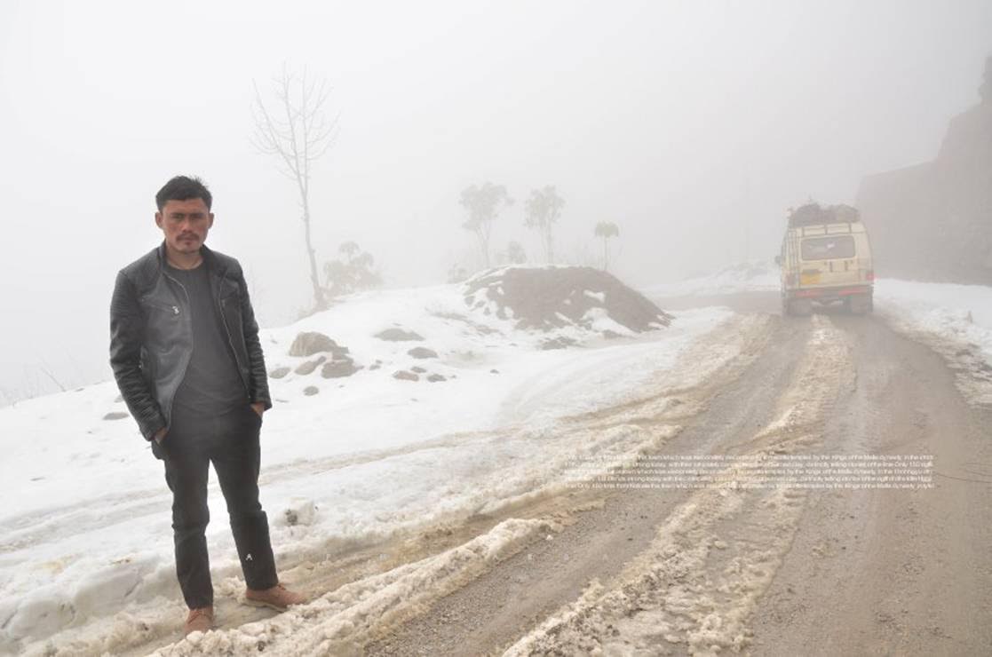
As we proceeded onward Nima updated me that after Lingtam and Padamchen it’s quite a steep ascent with Zuluk being the main halt before the final ascent . Thanks to the Indian Army today civilians can easily drive up to Jelepla or even drive down past Nathula Pass (the modern Indo-China Trade Gateway at 14200 ft to Gangtok the capital of Sikkim. The route through Rhenock and Rongli takes you to the first check post at Lightham. This is where you show your permits and register as the area above needs every visiting individual’s identification the area being and important border area. The condition of the mountain road from here till Kupup is excellent , it can put some of our renowned city roads to shame. Being a strategic route, it is constantly maintained by the army with a standard recoating schedule every three years. With very limited traffic the road is in excellent condition almost good enough to roller skate the full length while coming down. Padamchin is the final checkpost where the permit papers are submitted and I was told every human living in the area has to renew their individual permits once every year. Vegetation changes abruptly after Padamchin, so does temperature. The barren grass covered hills emerge with huge clouds crossing your path every now and then.
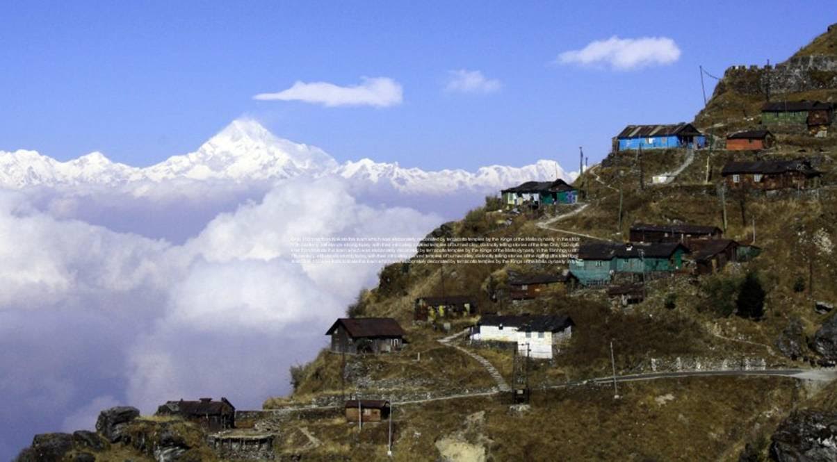
Zuluk is perched at 9500 ft up on a slope with steep mountains on three sides. To get a clear view of the Kanchenjunga massif one needs to travel several kilometers up , but this is the closest you can stay. The daily equation stands unchanged much as a thick layer of cloud completely whiteouts Zuluk by noon, so you need to capture all the magnificent sights before that unless ofcourse you are headed up next day like me. The hamlet is aptly called the Abode of the Clouds, even the local army station bears the name ‘Cloud Warriors’. As Gopal drives us up the steep climb to Zuluk he told us how hard the British soldiers worked pre Indian independence while this road was being built and people from numerous local villages helped them in building it but unfortunately after a few years the Jelepla pass was shut down and the trade route collapsed. Much later though another pass was opened called Nathula through which trade commences now , but that’s not much. Today with his unmatched enthusiasm with proven entrepreneur skills, he puts up tourists at his house on the edge of the cliff at Zuluk for a lovely home stay experience. His wife cooks sumptuous steaming meals while his daughter helps in making the guests feel comfortable. There are no hotels or lodges in Zuluk and it’s still the same as it used to be in the old days when the caravans with the yak trains used to arrive just before sundown to rest for the night. Accommodation is very basic with the rooms having their ingenious heating systems. The village consists of nine families and most of the men work for the military in the transit camp base a few thousand feet above Zuluk. A night halt at Zuluk is mandatory for acclimatization as the climb becomes steep from here.

Final Leg
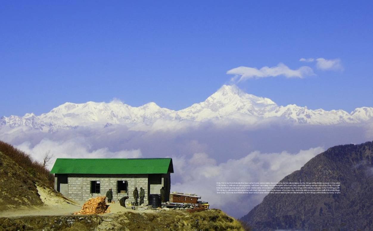
Huddled in the jeep we left Zuluk in the cold misty darkness at five next morning. Gopal as usual in the drivers seat, fired up the engine and started climbing the zig-zag road to the sunrise point. Zuluk and above was covered under a thick layer of snow till a few days back and as we climbed the zig zag road, the remains of the snow got thicker beside the road. The area is all green and yellow during the monsoons , now it was mostly brown with red patches in winter. As we reached the high bend in the road the sky was turning pink from the deep violet. Another fifteen minutes in freezing temperature with a view of a miniature Zuluk down below ,the sun showed its bright orange face from behind the peaks of Bhutan. Breath taking sight with a 360 degree effect the route was being wrapped in golden silk before my eyes. Right opposite the rising sun, the Kanchenjunga massif now visible almost from its base was changing colour dramatically by the minute. As I was wondering how many high altitude sunrises are this dramatic when the frozen speechless silence was broken by Gopal calling the team for some hot steaming coffee. Just what you needed !

Quite like flying an aircraft into, out and above the clouds as we continued climbing the zigzag road wondering how the ancient traders must have managed this steep ascent on foot and how tedious it must have been in this oxygen starved road up as the clouds beside the road were slowly gaining volume and altitude with the day. Past Thambi View point and Lungthang village , we spotted a couple of Monals the native bird of the region , a peacock lookalike beautiful creature . Progress was slow with Nathang Valley in view as Gopal pointed out a place where a woman reportedly spotted a Yeti a few years back , talk of local folklore. But what we actually couldn’t believe we saw on the road were bear footprints. Both big ones and that of a cub. We were the first vehicle passing after the snowfall and the road had these bear foot prints for several kms, the bears seem to have been walking on the road in the night. Kupup is about 35 kms from Zuluk at around 13,500 ft. When viewed from high up the lake resembles the contour of an elephant. Thats how the Elephant Lake at Kupup got it’s name. Frozen most of the year it’s water is used by Bhutan since ages and the elephant lake is also the nesting ground for red beaked chinese crows. A little ahead and you see the Jelep-la pass . Both Chinese and Indian Bunkers were clearly visible on both sides of the pass with the access roads servicing the bunkers meandered up the slopes but strictly off limits. The full Kupup area with the meandering trails to Jelep-la and the Elephant lake below makes an amazing sight I’m sure would have raised the spirits of the traders of the ancient silk route as well.

As I stood beside the Kupup lake and looked towards the end of the route on the Indian side as it disappeared beyond the Jelepla pass I wondered how many thousands of people would have crossed it from either side to exchange goods , money and knowledge in the process. The next phase of the journey was downhill via the Chhangu lake and Gangtok the capital of Sikkim as we left the silk road and slowly mingled with dense civilization as we drove downhill.


