Exploring New Frontiers – Ladakh
8 min read
The road was barely a few metres wide, and there was a wall of snow outlining both sides. The traffic had come to a standstill and a few people had stepped out of their cars to help direct traffic, in an attempt to ease the jam. Nothing seemed to be moving – definitely not my toes, which were completely numb from the cold! I got out of the car and struggled to walk a few steps, but my head felt dizzy and I thought I was going to faint.
Here, on the 16,000-feet high Baralacha La Pass that connects Himachal Pradesh to Ladakh in the state of Jammu and Kashmir via the Leh-Manali highway, traffic jams are common. The stretch of cars, oil tankers, busses, trucks and bikes along the pass can go on for miles, and this is usually caused by the swelling of the streams, inundated with melting snow. Today, it was an oil tanker with engine trouble that was blocking the already narrow road
A Drive to Remember
But don’t let the thought of traffic jams dissuade you from visiting; the road to Ladakh promises an incomparable drive.
Spread across nine high altitude passes, with the lowest at 12,000 feet and the highest above 18,000 feet, Ladakh has one of the highest motorable roads in the world! Here, you can find five breathtakingly beautiful high altitude lakes, with the highest at 15,000 feet, and two protected under the Ramsar convention, being natural habitats of at least three species of endangered wildlife. This region is also home to three Himalayan national parks, two 1,200-year-old monasteries and numerous villages. While the drive through the heart of Ladakh is considered one of the world’s most scenic, it is also one of the most difficult too.
My journey to Ladakh started one early morning from Manali, a small valley town in Himachal Pradesh, from where the road ascent to the Northern Himalayas begins. After crossing the Beas River beside Manali, I spotted the golden peaks above the Rohtang Pass, as my car began its long ascent up the pass, at 12,480 feet.
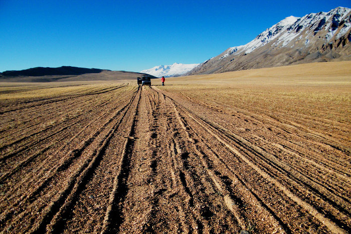
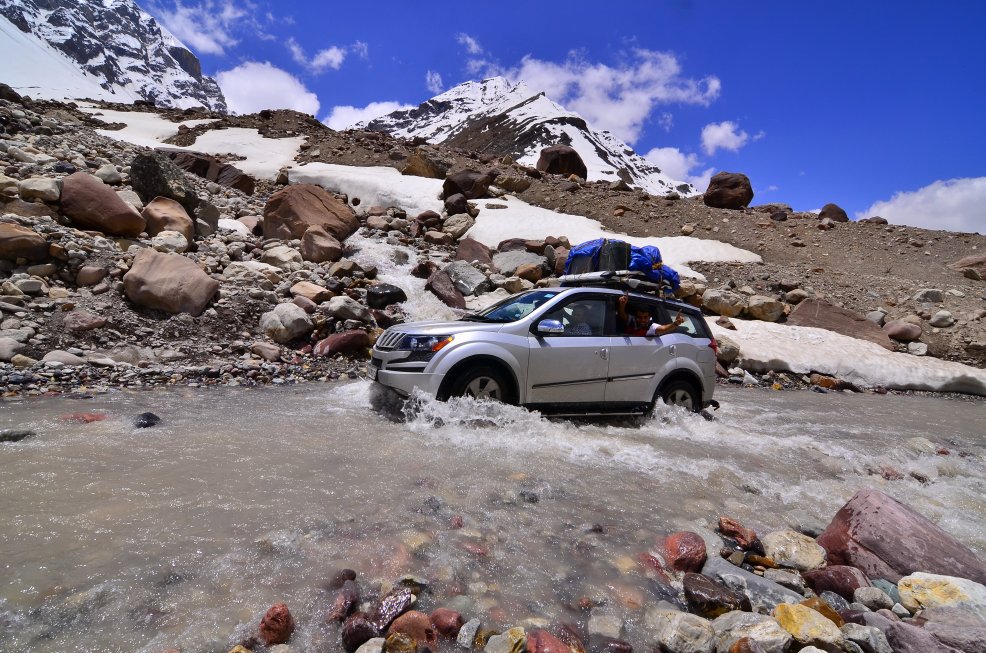
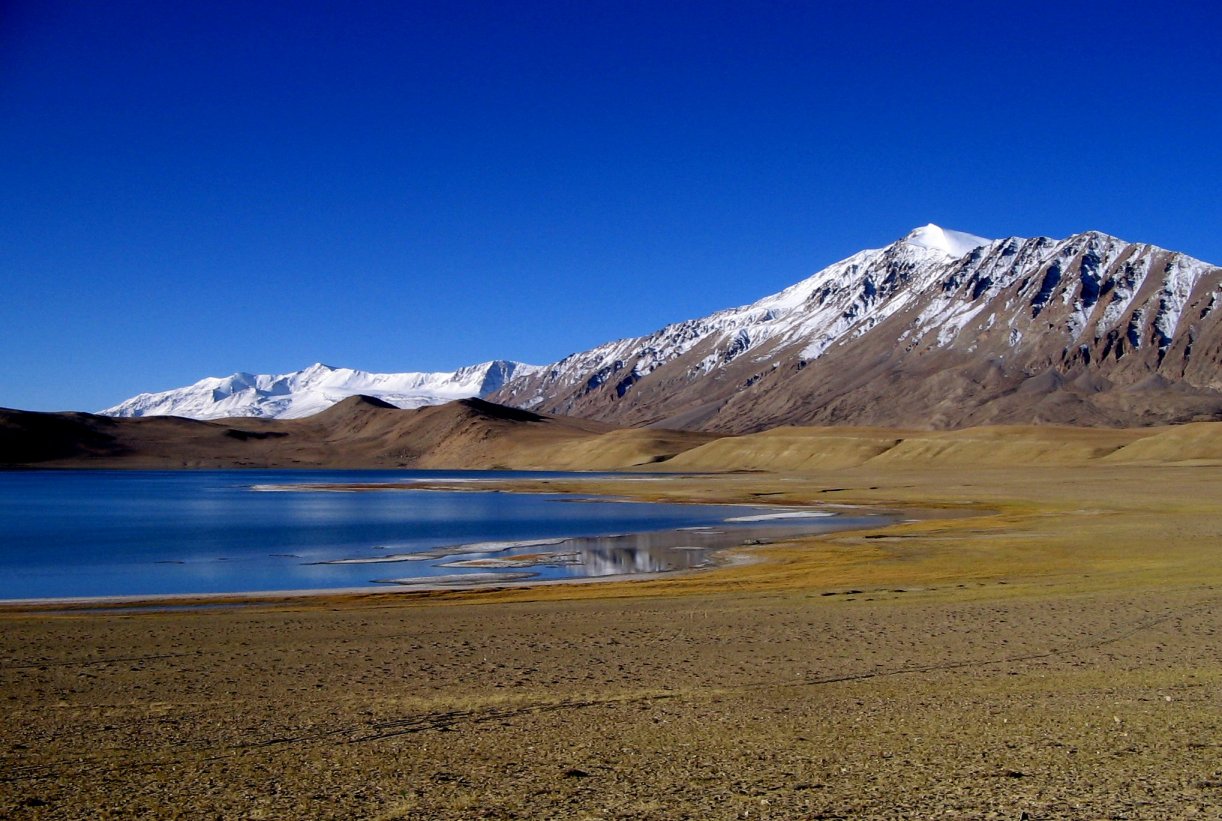
With every turn, the views became more and more breath-taking. The road surface varied wildly – from bumpy asphalt to dirt tracks cut by glacial streams. This journey from Manali to Leh, along different river valleys, generally takes around 24 hours, with an overnight stop at Sarchu, a major stopover between Himachal Pradesh and Ladakh. But I wanted to move towards the two lakes Tso Moriri and Pangong Tso, instead of heading to Leh. So, after entering Ladakh, I headed to Pang, from where I turned right towards the Changthang Plateau, which took me towards Tso Kar, a small lake and home to a host of wildlife, and Tso Moriri.
Reaching Ladakh
Reaching Ladakh is not easy, unless you decide to fly to Leh, its largest town. But then, if you fly, you miss everything in between! There are two highways that lead to Ladakh. The Manali-Leh highway that starts in the state of Himachal Pradesh and the Srinagar-Leh highway, which leads from Leh, the capital city of Ladakh, to Srinagar, the capital of the state of Jammu & Kashmir. Some travel to Ladakh by motorcycle, while braver souls manage it by cycling. I chose to navigate the Manali-Leh highway by car, which allowed me to experience the journey in a bit more comfort.

Along the Highway
After crossing the mighty Rohtang pass, the views over the jagged peaks became even more scenic, with coniferous forests and grassy mountain pastures. With each turn, the glaciers seemed to get nearer. A sharp descent at the base of Rangcha Mountain brought me to the confluence of the Chandra and Bhaga rivers at Tandi, a tiny village with an even tinier petrol station, the last point to refuel before Leh.
Right beside the pump, I had a hot bowl of Tibetan garlic soup, before setting off again, heading towards scenic Keylong and Darcha villages, over the bridge. Keylong, an important halt on the route, is a small hamlet with a couple of hotels, eateries and beautiful valleys where the locals cultivate vegetables. The road climbed steadily on, along a mountain side of wine-red and pale-green fields to Zingzing Bar, where most travellers stop for tea and snacks before the long drive up the Baralacha La pass.
As I left this desolate land, I approached Baralacha La, a pass at 16,000 feet that stretches over what is said to be the largest glacier in Asia. The wide pass forms the head of three valleys: Bhaga, Chandra and Yunan. By the time I arrived at Sarchu, a tented halt on a long wind-swept plain beside the Bhaga River in Himachal, I was completely exhausted and needed rest. After a dinner of rice, vegetables and soup, served in my cosy tent, I slept peacefully through the night.
Into the Himalayas
The next morning, crossing over from Himachal Pradesh to Ladakh, the car commenced its climb to the Lachlang La pass at 16,188 ft. I developed a mild headache, a symptom of acute mountain sickness, which is a serious consideration when you travel to Ladakh. It can strike anyone, regardless of age or fitness. Hoping to see it through with another night’s sleep and lots of water, I pushed on, soaking up views of rugged, lilac-tipped mountains, as I slowly moved up from the Indian plains towards the Changthang plateau. It was a small price to pay.
With jagged white peaks jutting towards the heavens, the Himalayas curve some 2,500 kilometres across India, Pakistan, Nepal, Bhutan and Tibet. The name of this famed mountain range, the ultimate trekking destination, means ‘abode of snow’. But, white is not the only colour here. There are deep turquoise lakes, verdant valleys, desert plateaus, pine-scented forests, as well as ruby-red and pink rhododendrons.
I saw Buddhist monks swathed in maroon, Hindu sadhus (holy men) in orange, and multi-coloured prayer-flags fluttering their mantras in the breeze. Villages and monasteries clung to hillsides, their people charming, resilient and proud of their rich culture.
The Cold Desert Plains
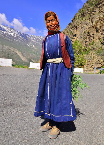
Straight out of the old world, marked by silk routes, cold deserts and reclusive nomads, Changthang plateau in Ladakh held the allure of a bygone world for me. As I entered the area, near Pang, I could see why it was called the ‘Eastern flat land’. Once dominated by an ancient culture known as Zhangzhung, which later merged with the Tibetan culture, Changthang had always been, for me, a romantic place in the yellowing pages of travelogues. But, here I was, in a modern CRV, speeding on a dirt road over the plateau, above 14,000 feet in the land of the Changpas. The nomadic people live an intriguing life, braving harsh terrain, moving settlements, travelling with their yaks and goats, and exchanging pashminas and salt (extracted from lakes) for food.

Their settlements were scattered around pastures. I saw a few yaks and goats grazing, while a few boys watched over them. While most of the Tibetan Changthang is now protected and contains the Changthang Nature Reserve – one of the largest environmental reserves in the world – the Ladakh Changthang area stretches for nearly 1,600 kms and is only a fraction of the reserve.
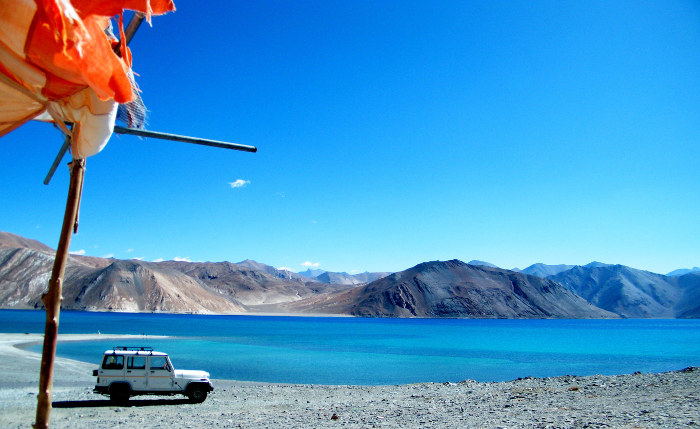
However, the Ladakh Chanthang area is home to the Changthang Wildlife Sanctuary, and it has been a historically important route for travellers journeying from Ladakh to Lhasa in Tibet. The area is surrounded by two major lakes: Pangong Tso, which is hugely popular, marked by burgeoning crowds, and the Tso Moriri, a gorgeous lake at 15,000 feet, which is a lesser known attraction. This is where I was headed .
TSO MORIRI
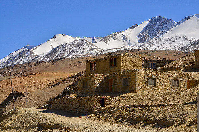
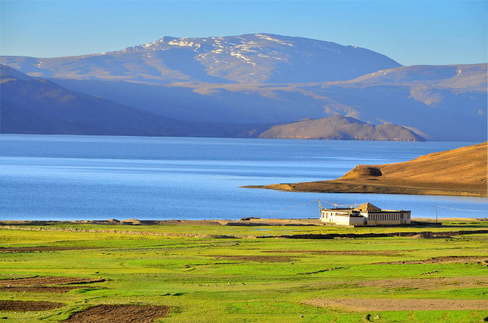
After crossing the settlement at Sumdo, a tiny half abandoned windy village on the slopes of a dusty mountain, I caught my first glimpse of the Tso Moriri lake, glinting in the evening sun. I crossed Korzok, one of the world’s highest inhabited villages, which is nestled on the south-west bank of Tso Moriri. Away from the village and the handful of campsites, I chose a secluded spot right by the lake and set up camp for the night. Drinking hot soup and watching the colours of the sinking sun dissolve into the blue of the lake was perhaps the best way to end the day.
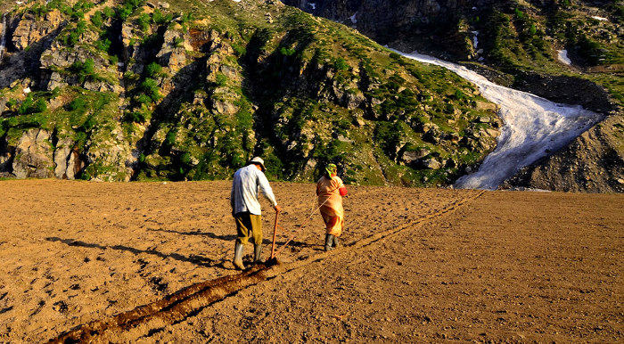
The next morning, a search for a bowl of yoghurt took me to the nomadic settlement nearby. On the way, I took in a bird’s eye view of the entire emerald lake, the green cultivated fields beside it, and the Korzok village beneath. Sturdy tents made of yak wool dotted the bucolic landscape. The people there barely understood me, but some gesticulation and a few photographs later, I succeeded in bartering for a mug of yoghurt. On my way back, just before sundown, I met some of the older nomads, on their way to the local Korzok monastery, dressed in long, flowing robes and rotating their small prayer wheels. They live in a very different world from me, amidst peace and simplicity.
Once on flat ground again, I crossed the stream that flowed by my campsite and entered a vast, green plateau, akin to the Changthang of my imagination, where fully grown yaks sat stoically like boulders, while their calves grazed against snowy peaks.


The day after was tiring; it took me nearly an entire day’s drive to exit Changthang. The landscape was nothing short of a pictorial feast, with multi-hued mountains, massive grasslands, arid stretches, virgin lakes and high passes. As my car neared the flat plains near Tso Kar, a herd of graceful, brown and white kiang (wild ass) dashed across the road. I revelled in the sight, for it was a fitting close to my overland adventure.


